Three adventures. One little boat. A very big year.
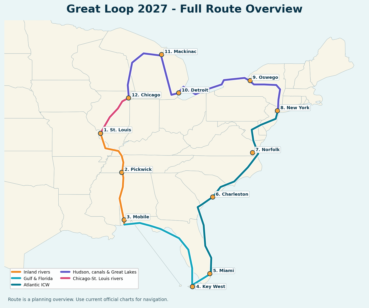
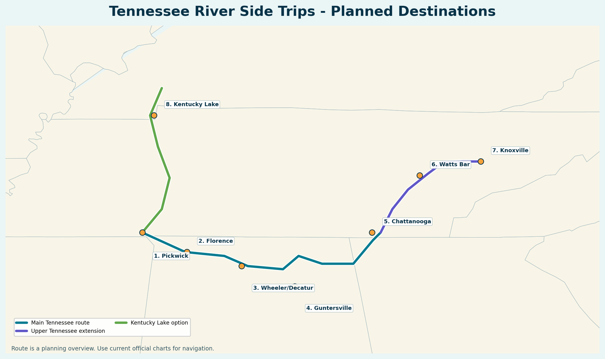
Beginning in spring 2027, two adults, Remi the Belgian Malinois, and Ruger the Doberman will take the rebuilt 1982 Yukon Delta 25 from a Missouri River shakedown into the Great Loop—with time reserved for exploring the Tennessee River system.
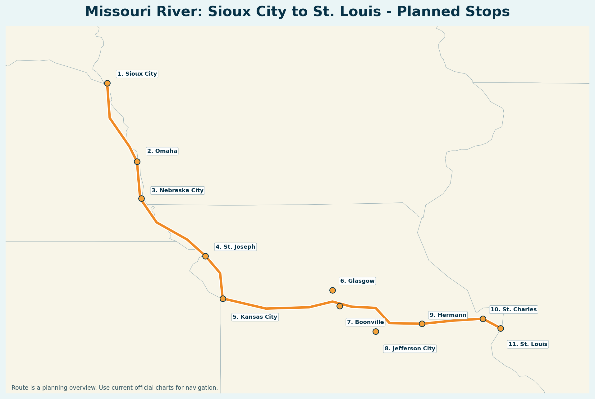
This geographic planning map uses an OpenStreetMap basemap and real waypoint coordinates to show how the Missouri River shakedown, Great Loop, and Tennessee River side trips connect. Route lines are planning approximations—not navigation tracks.
Missouri River: Sioux City to St. LouisGreat Loop routeTennessee River side trips
Each free detailed master-plan PDF includes route and seasonal frameworks, day-by-day operating plans, fuel-range tables, provisioning, marina and anchorage strategy, lock and weather procedures, dog-ready planning, safety contingencies, call sheets, and authoritative pre-departure resources.
TRIP 01 • SHAKEDOWN
Missouri River: Sioux City to St. Louis
Approximately 734 river miles downstream with relaxed travel days and major resupply stops.
Accurate regional route map with numbered planned stops.
Refuel early: the 133–160 nautical-mile figure uses the full theoretical supply. Real trip legs will preserve a generous reserve for current, wind, detours, unavailable pumps, and unexpected delays. Actual sea-trial fuel burn will replace these assumptions before departure.
Balanced overnight plan
Quiet anchorages and public docks when suitable, plus regular marina stops for fuel, water, groceries, laundry, pump-out, maintenance, shore power, and comfortable breaks.
Remi & Ruger aboard
Every travel day will account for shade, ventilation, drinking water, boarding safety, dog flotation, exercise, secure shore access, and an emergency relief plan.
BEFORE EVERY LEG
Conditions can change faster than the itinerary
The guides are working master plans. Before and during each leg we will verify current charts, river and lake levels, weather, lock and bridge restrictions, marina status, fuel availability, and local guidance.
Safety note: The illustrated map and downloadable guides are for preliminary planning only. They do not replace official charts, current notices, weather information, local knowledge, or professional navigation advice.